UN
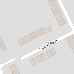
5 Samuel Road
£ 165,000
Description
We don't have a Description for this property.
- Bedrooms
- 3
- Bathrooms
- 0

Leaflet © OpenStreetMap contributors
The heatmap indicates the level of crime in the area. The color of the heatmap indicates the crime severity and recency.
Metrics Year-on-Year
- Average area value
- 247,955.00 £Increased by 4.61 %
- Average area rental value
- 1,040.00 £/moDecreased by 8.05 %
- Est rental Yield
- 5.03 %Decreased by 12.22 %
- Crime Rate
- 53.00 %Unchanged by 0.00 %
from 237,025.00 £
from 1,131.00 £/mo
from 5.73 %
from 53.00 %
Nearby Schools
| Name | Type | Ofsted | Distance |
|---|---|---|---|
| Lionwood Junior School | Academy Converter | Good | 0.52 KM |
| Thorpe Hamlet & Heartsease Children'S Centre | Children's Centre | 0.52 KM | |
| Lionwood Infant And Nursery School | Academy Converter | Outstanding | 1.01 KM |
| The Open Academy | Academy Sponsor Led | Requires improvement | 1.06 KM |
| Heartsease Primary Academy | Academy Converter | Outstanding | 1.07 KM |
Images
Nearby Streets
| Name | Average Price | Average Sqft | Distance |
|---|---|---|---|
| Harvey Close | £ 362,500 | 0 | 0.00 KM |
| Lime Tree Avenue | £ 265,000 | 0 | 0.00 KM |
| Orchard Close | £ 300,833 | 0 | 0.00 KM |
| Marlborough Court | £ 0 | 0 | 0.00 KM |
| Balfour Street | £ 325,000 | 0 | 0.00 KM |
Nearby Transport
| Name | NLC | TLC | Distance |
|---|---|---|---|
| Norwich | 7309 | NRW | 1.82 KM |
| Salhouse | 7318 | SAH | 8.99 KM |
Nearby Listings
| Address | Price | Type | Score | Distance |
|---|---|---|---|---|
| Knox Close, Norwich | £ 240,000 | BUY | Unknown | 0.07 KM |
| Honey Close, Norwich, NR1 | £ 200,000 | BUY | Unknown | 0.08 KM |
| Honey Close, Norwich, NR1 | £ 290,000 | BUY | 6 / 10 | 0.09 KM |
| Hilary Avenue, Norwich | £ 250,000 | BUY | Unknown | 0.13 KM |
| Garage and land, Honey Close, Norwich, Norfolk NR1 4LJ | £ 5,000 | BUY | 6 / 10 | 0.16 KM |
Nearby Properties
| Address | Price | Distance |
|---|---|---|
| 3 Samuel Road | £ 210,000 | 0.00 KM |
| 12 Samuel Road | £ 230,000 | 0.00 KM |
| 7 Samuel Road | £ 152,000 | 0.00 KM |
| 10 Samuel Road | £ 272,000 | 0.00 KM |
| 5 Samuel Road | £ 165,000 | 0.00 KM |